
Satellites Over a Burning Planet: What NASA FIRMS Reveals About the Global Fire Crisis
Discover how NASA FIRMS satellite data is used to detect, monitor, and analyze forest fires worldwide in near real time.
CLIMATE TECH AI
1/5/20263 min read
Global forest and wildfire activity has intensified over the past two decades, with 2024 standing out for record-breaking burned area in several regions and continued confirmation that climate change is amplifying extreme fire behavior. Updated satellite and monitoring datasets now show that forest fires are burning more than twice as much tree cover each year as they did 20 years ago, while 2024 data highlight severe outbreaks in the Amazon, central Africa, and boreal regions.
Forest fires are getting worse- New analysis using University of Maryland tree cover loss data (2001–2024) shows that forest fires now burn more than twice as much tree cover annually as they did two decades ago.
Fire-related tree cover loss accounts for a growing share of global loss, and dangerous smoke exposure from wildfires is now estimated to cause over 1.5 million deaths each year.
Extreme heat waves driven by climate change are already about 5 times more likely than 150 years ago, drying landscapes and creating more favorable conditions for large, high-intensity fires.
If you’re evaluating use cases, stuck at the pilot stage, or thinking about using near real time fire data, then reach out to us at info@dimensionalanalytics.com for more insights and implementation techniques for your unique use cases.
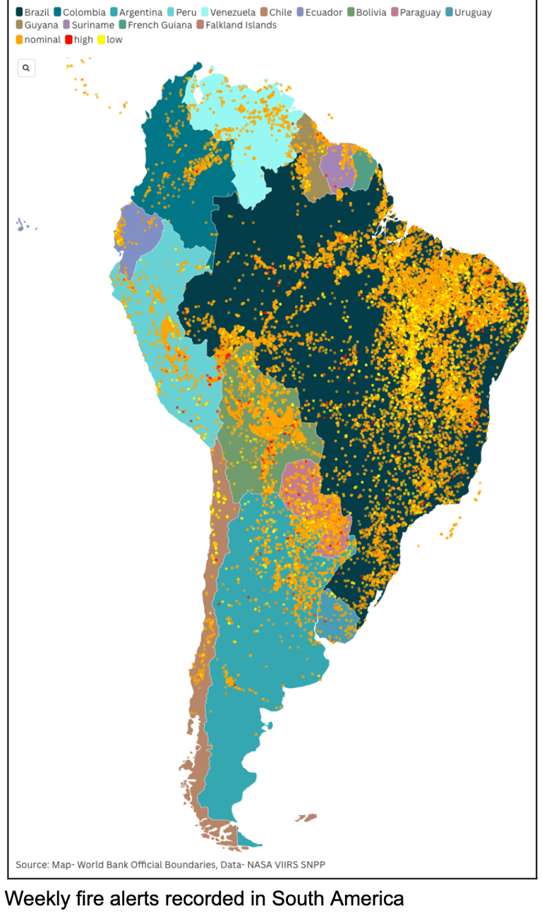
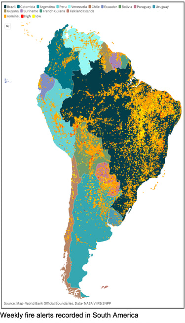
NASA FIRMS and how it sees fires ?
NASA’s Fire Information for Resource Management System (FIRMS) uses MODIS (∼1 km) and VIIRS (∼375 m) to detect active fires and thermal anomalies globally in near real time, including ultra‑real‑time coverage for much of the U.S. and Canada.
Each detection is a hotspot at the center of a satellite pixel, which means the reported point is an approximate fire location and the actual fire can be much smaller than the pixel footprint.
FIRMS classifies detections by confidence (low, nominal, high), and documentation highlights common artifacts such as sun glint in daytime and misinterpretation of hot smoke or plumes at night, so users must interpret low‑confidence points cautiously.
2024–2025 regional fire patterns
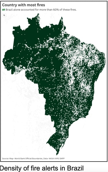
Amazon and Brazil- According to Brazil’s space agency INPE, the Brazilian Amazon recorded about 24,900–20,000+ fire hotspots from January through July 2024, the highest for that period since 2005 and roughly a 76–98% increase compared with 2023, confirming an exceptional fire year. These hotspots align with extensive deforestation and degradation processes, with civil society overflights documenting large areas of burning forest and heavy smoke across key Amazon states.

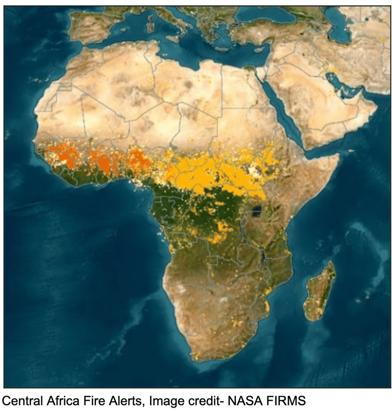

Central Africa: DRC and Angola- In one week of August 2024, the global burned area from wildfires was about 64% higher than any other week since 2012, driven largely by Africa, where around 22 million hectares burned. Angola and the Democratic Republic of the Congo were among the most affected, with large tracts of savanna and forest landscapes burning and contributing a substantial share of the global burned area that week.
Boreal regions: Russia and Canada- Long‑term satellite analyses show that extreme wildfire events have become more frequent, larger, and more intense in boreal forests of northern North America and Russia, with warmer nighttime temperatures allowing fires to remain active overnight. Recent dashboards from Global Forest Watch and VIIRS alert products report thousands of high‑confidence fire alerts annually in Russian regions, though current counts remain below the most extreme years such as 2021.
Interpreting day vs. night detections
Nighttime detections often dominate high‑confidence alerts in high‑latitude regions because warmer nights and reduced solar interference improve the sensor’s ability to see active fire fronts. However, users must consider confidence levels and sensor caveats: low‑confidence daytime points can be caused by sun glint, and some nighttime detections can be tied to hot smoke plumes displaced from the actual fire line.
Why this matters for climate and policy
Satellite records now clearly link the rise in extreme fires to a warming climate, especially in temperate conifer and boreal forests, where the largest increases in extreme fire behavior have been detected. Reducing future fire risk at scale requires both direct fire and land‑management interventions and rapid cuts in greenhouse gas emissions to weaken the fire–climate feedback loop highlighted in recent WRI and NASA assessments.
If you’re evaluating use cases, stuck at the pilot stage, or thinking about using near real time fire data, then reach out to us at info@dimensionalanalytics.com for more insights and implementation techniques for your unique use cases.